 Dörzbach is a town in the Jagst river valley in Hohenlohe district in south central Germany at 49°23′N 9°42′E and the site of 3 historic castles, Chapel of St. Wendel (in a limestone hillside), and a stone bridge built in 1808-1810 for King Frederick I of Württemberg. Records for the Dörzbach area date to 1230, but the modern incorporation was approved during 1972-74. DÖRZBACH now includes HOHEBACH. Dörzbach includes Dörzbach proper (1465 inhabitants) and from the unincorporated former municipalities, Hohebach (with the hamlets Eisenhutsrot, Heßlachshof and Wendischenhof, together 646 inhabitants), Laibach (183 people) and Meßbach (170 inhabitants). In the area of the community of Dörzbach, within the limits set 31 December 1971, are the deserted villages of Albertshof, Dürrenhof and Rortal. In the area of former municipality Hohebach are the towns Lieboldsbronn, Eschbronnen and Ripperg. In the former municipality of Laibach lie the villages of Büchelich and Dacht. In the former municipality Meßbach is found the town Niedermeßbach.
Since 1986, a commemorative plaque in the Hohebach section on the former synagogue,which was demolished during the November Pogrom of 193 by SA stormtroopers. In the Jewish cemetery is a memorial stone for the last eight Jewish inhabitants, who were deported in the 1940s and murdered. [Feb 2013]
74677 Baden-Württemberg
(DOERZBACH)
SOURCE: Gerz
DISTRICT: Hohenlohe, community of Doerzbach (German: Dörzbach)
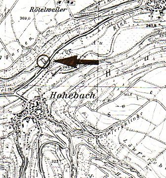
LOCATION OF CEMETERY: Jagsttalstrasse (north of Hohebach detailed location).
IN USE: From 1852 until 1940.
NUMBER OF GRAVESTONES: 300.
DOCUMENTATION:
- 1988 Photographs of all gravestones and cemetery layout by durch Zentralarchiv.
- Complete cemetery documentation by Naftali Bar-Giora Bamberger although published only after his death.
- Until 1741 the Jewish community of Hohebach used the cemeteries first in Unterbalbach and subsequently in Weikersheim for burials. From 1852 onwards they had their own cemetery in Ailringer Strasse (renamed Jagsttalstrasse). A Hohebach Jewish merchant, Mäntle Wolf Strauss, had earlier acquired various local vineyards, which he subsequently sold to the "Israelitische Friedhofsgemeinde" (Jewish Cemetery Association) whose members included the Jewish communities of Hohebach, Ailringen, Mulfingen, Dörzbach, Hollenbach, Laibach and Altkrautheim (later also Künzelsau). The cemetery was walled in and dedicated in 1852.The first funeral, that of Fani Strauss, the 17-year old daughter of Mäntle Wolf Strauss, took place on 8th March 1852. The last funeral was that of Judit Julchen Stern from Dörzbach, in January 1940.
- Overall photographic cemetery view by Württemberg 1932, page 88.
- History by Künzelsau 1993, page 3.
- Complete cemetery documentation by Bamberger 2002, pages 775 - 956.
- Numerous photographs of gravestones and general views in Alemannia Judaica and here.
- A commemorative stone was dedicated by the town of Hohebach on 30th June 2002 to the memory of the last 8 Jewish citizens of their town, who were deported during 1941/1942 and were murdered in concentration camps.
SOURCES: University of Heidelberg and Alemannia Judaica.
[Researched and translated from German January 2008]
To see information and photographs of individual gravestones in cemeteries in Baden-Wuerttemberg, click on this link and follow the directions on that page.